• ALL TOOLS
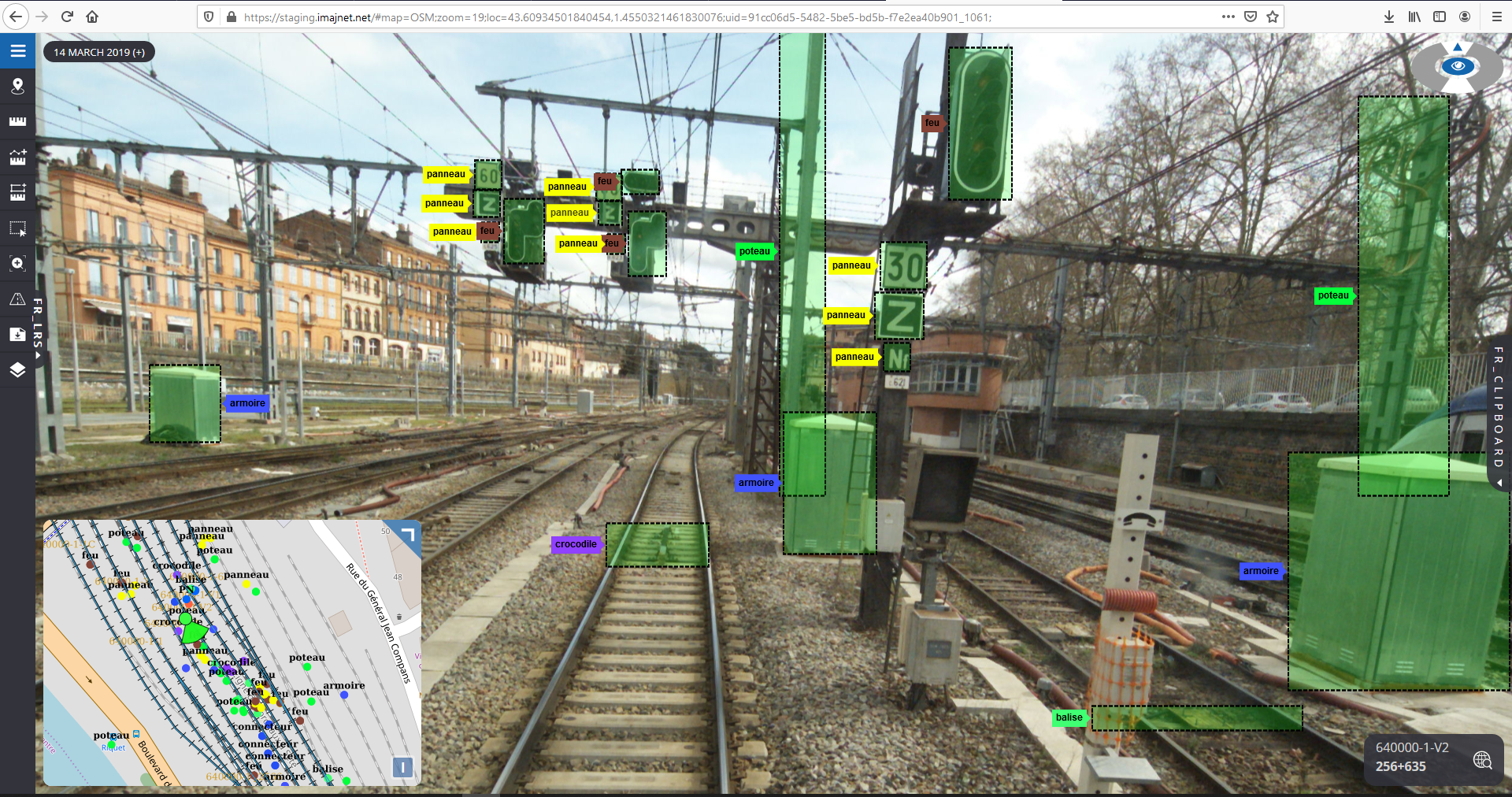
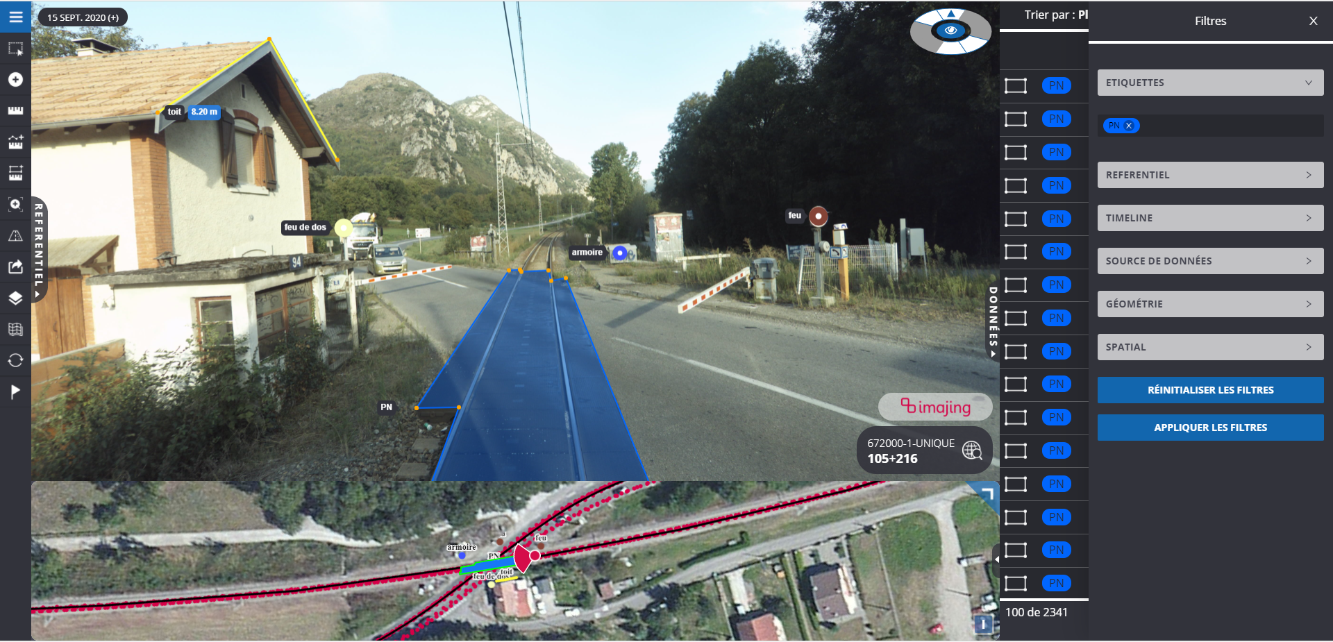
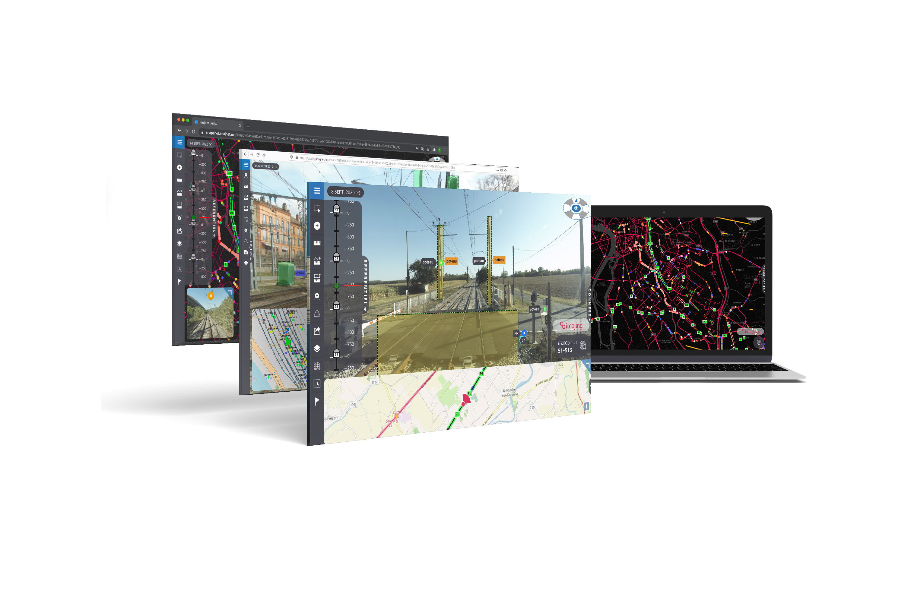
  • imajnet® is a safe and powerful featured web service giving access to nationwide surveys for any entity within an organization.

    It is designed to support transportation organizations' workflow with an access to up-to-date geo-referenced images anytime and anywhere, supporting asset management, maintenance and monitoring. Can serve any department within an organization for a simplified and more performing collaborative work.

    PRODUCTION

    imajnet® Gecko receives the field events produced with its smartphone through the imajnet® LRS App Gecko mobile application. to enrich and centralize the information we produce.

    SHARING

    The possibility of making your own data public so that your colleagues or your team can benefit from your work.

    ARTIFICIAL INTELLIGENCE

    imajnet® Gecko integrates artificial intelligence services able to search, localize in 3D and produce a structured base of the infrastructure.

    AN ENRICHED RANGE OF TOOLS

  • Capture by area selection in image (ROI) or by photogrammetric triangulation.
  • An unlimited vocabulary to describe the equipment in which you participate.
  • A data management and filtering tool.
  • A multi-format export tool.
  • MAKE THE USER EXPERIENCE A PRIORITY

    A new suite of tools to access and exploit imajnet imagery:

  • a modernized interface,
  • a rethought ergonomics,
  • a more fluid navigation.